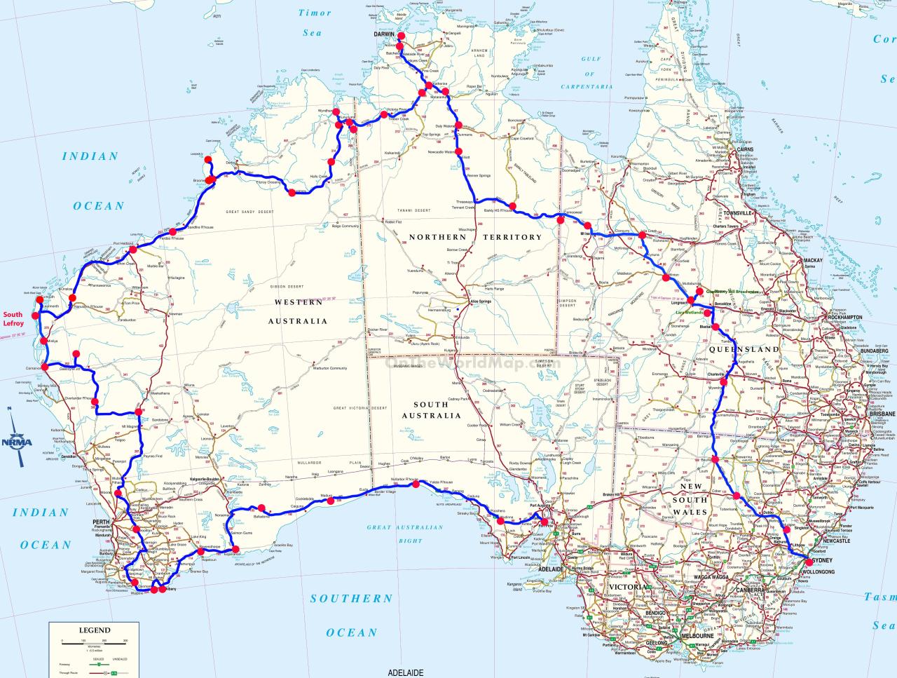
Esperance to Whyalla - 1 to 8 October
Esperance
On our last day in Esperance we went for a drive to see the beautiful beaches one more time. Along with Demark, we think these are the most stunning beaches in Australia, but certainly not much good for surfing.
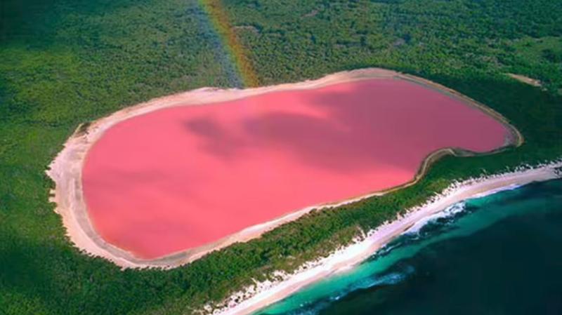
We wanted to go and see the famous Pink Lake (Lake Spencer), but its no longer pink. Although it's supposed to still be a beautiful grey lake, not being pink made it just another lake, so we didn't bother. It lost its pink colour around 2007, when the salinity declined. Once the lake water reaches a salinity level greater than that of sea water, the temperature is high enough, and if adequate light conditions are provided, the algae begins to accumulate and grows in the salt crust at the bottom of the lake.
Lake Hillier - This is what the Pink Lake should look like.
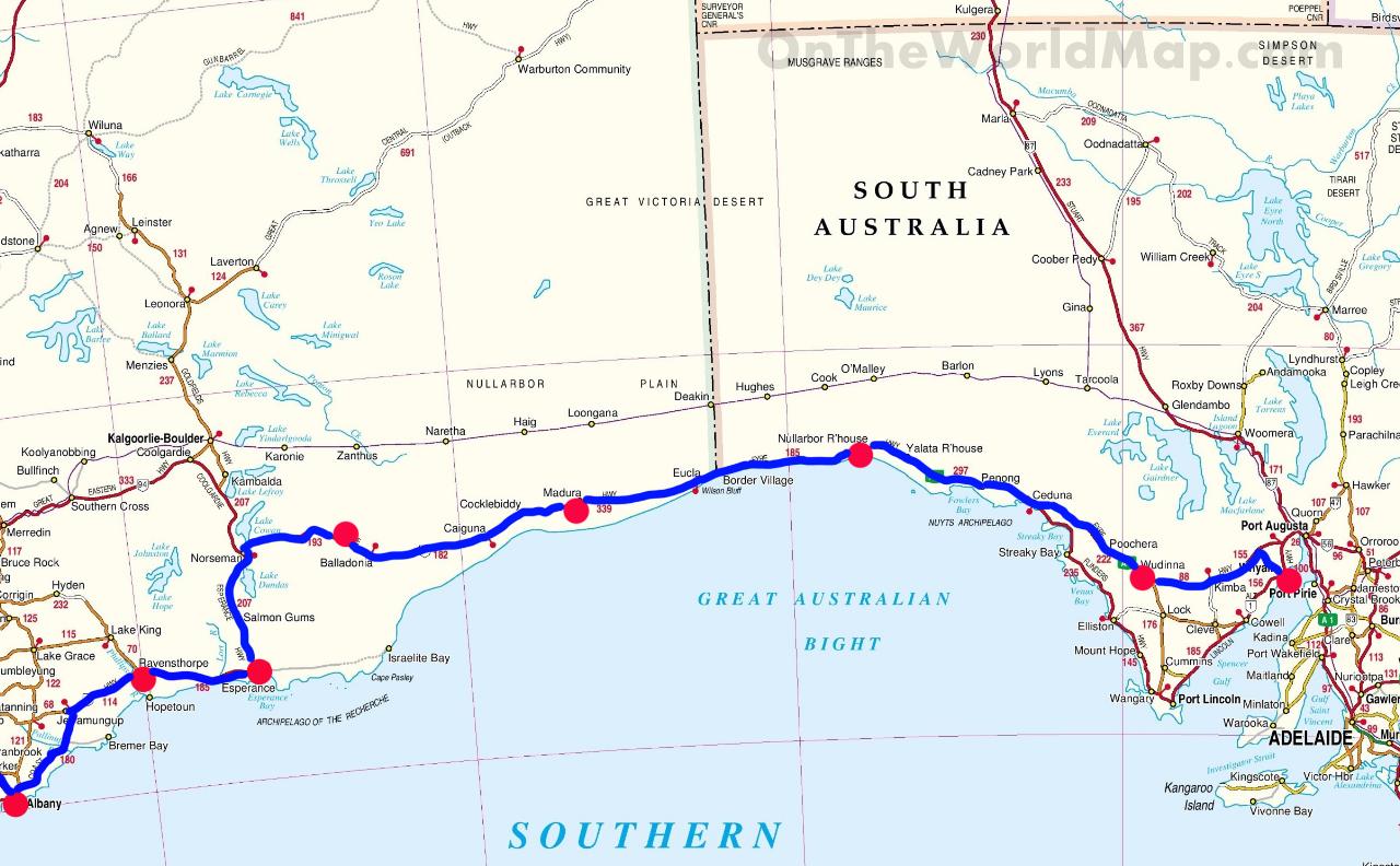
Our next few days were going to be crossing the Nullarbor, and we really wanted to stock up on a few more shopping supplies, as our options would be pretty limited, i.e. no supermarkets! So before leaving on Sunday morning we called into Woolies - closed on Sundays. How about IGA? Also closed. (We learnt later that the IGA did open, but after we'd left.) Our route took us through Norseman, and a quick Google search confirmed that the IGA in Norseman was open until 1pm.
Esperance is a major working and tourism town, so it still catches us out that these services are not available.
So it was off to Norseman before 1pm, which we did easily enough and managed to get sufficient supplies for our drive across the Eyre Highway (Nullarbor).
We were really looking forward to seeing the Bunda Cliffs again, and camping at such an incredible location right on the edge of Australia. Unfortunately the cliffs are environmentally fragile with the edges breaking away in some areas. Many of the camping places are closed, with Wikicamps also reporting that all cliff face camping spots have been closed. This information wasn't quite true, and there are still many camping areas still open.
Once we left Norseman we were finally heading east towards home. The gale force winds were relentless, and stayed that way for 4 days.
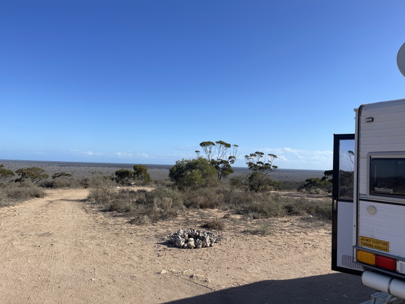
Madura - On Top Of The Ridge
Our first night was Madura - a cliff top camp above the Roadhouse and a long way from road trains and traffic noise.
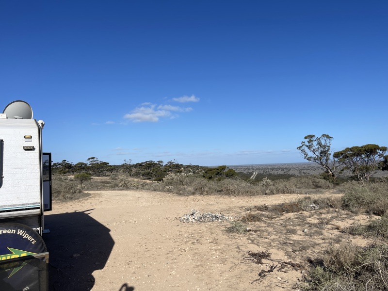
Far reaching views from above.
It was blowing a gale up there, so definitely no sitting outside enjoying a nice fire. The views were amazing and we were back far enough from the cliff that the van wasn't being buffeted around. It's a huge area and able to accommodate many campers, with our nearest neighbour about 200 metres away.
Time Changes
This is certainly a baffling situation when driving across Australia and particularly going along the Eyre Highway.
Heading east from Caiguna in Western Australia a sign tells you to "Advance Clocks 45 minutes". Is there anywhere else in the world with a time zone on the 15 or 45 minute mark? Nowhere, only in Western Australia. Just another "Only in Western Australia" fact.
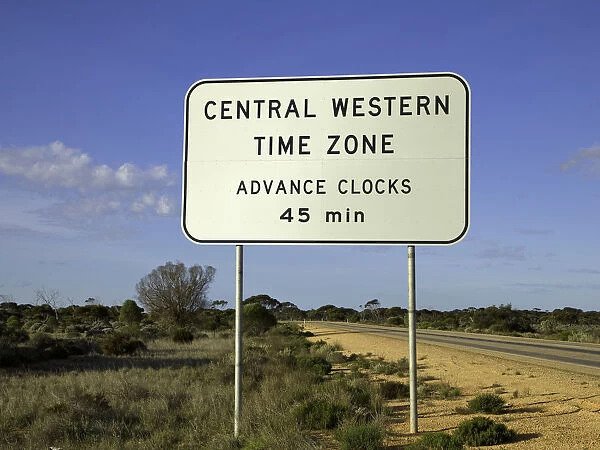
Is it an official time zone, on the 1/4 hour? We don't think it is, but it's certainly used in this area. This time zone only covers a very small area of south-east corner WA.
As you head further east from Eucla, some 340kms later, the time changes again to South Australian time. Another 45 minutes needs to be added, but as Daylight Saving started the very day we crossed, we had to add another 1 hour and 45 minutes.
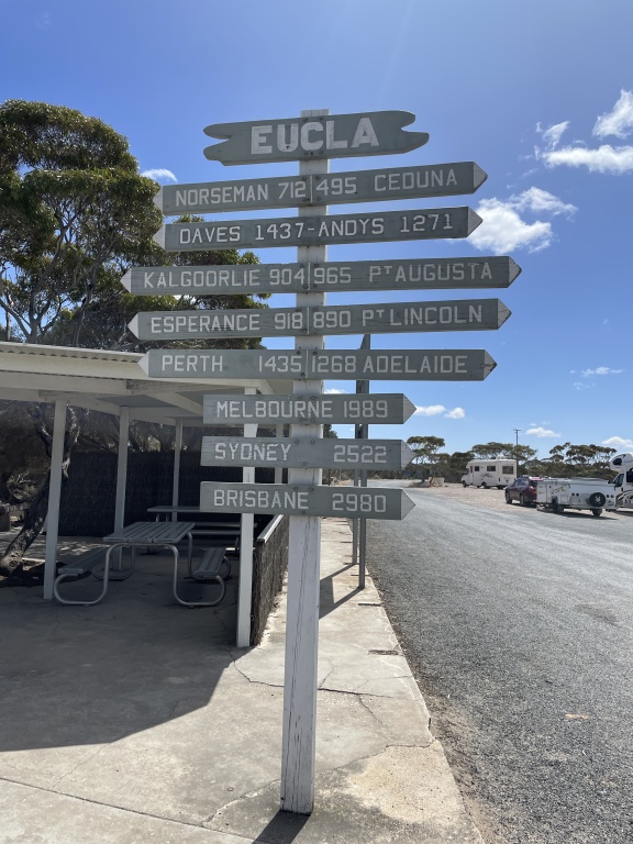
Sydney is still 2,522 kms from Eucla - almost home!
Our car's clock is controlled by the GPS and the phones are also self setting. Nothing showed the same time and both our phones showed different times. So what time is it? Buggered if we knew. We left the clocks in the caravan on WA time, so at least we knew when we should be eating and sleeping.
So in one days drive we passed through 3 time changes and lost 2 1/2 hours!
Nullarbor Plain
The Nullarbor Plain (Latin: nulla feminine of nullus, "no", and arbor, "tree") is part of the area of flat, almost treeless, arid or semi-arid country of southern Australia, located on the Great Australian Bight coast with the Great Victoria Desert to its north. It's the world's largest single exposure of limestone bedrock, and occupies an area of about 200,000 square kilometres. Amazingly flat as far as you can see and no trees.
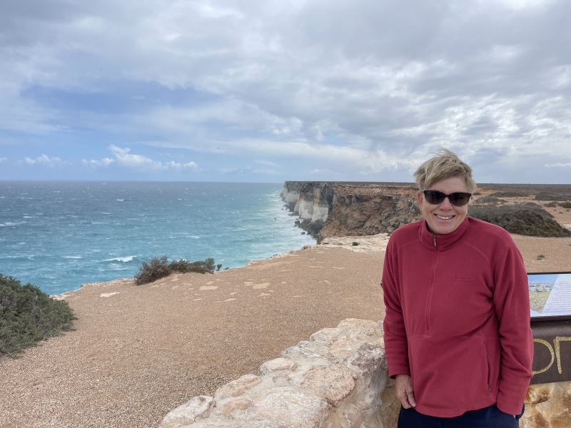
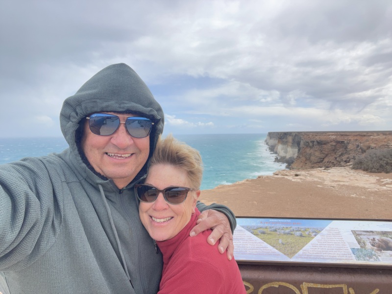
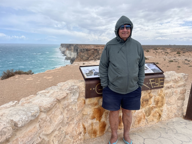
Bunda Cliffs
The Bunda Cliffs run along the Nullarbor coast in South Australia, and it's amazing to see them yet again, but the wind was still gale force. The car and van were rocking from side to side when we pulled up, and we had to hang onto the car doors so they didn't fly off and start sailing towards South Australia.

As soon as we got outside the car we both copped a face full of sand and dirt. A shower before bed was essential that night - once to get the sand out of our eyes, then another rinse to remove the sand that had just been washed out of our eyes!
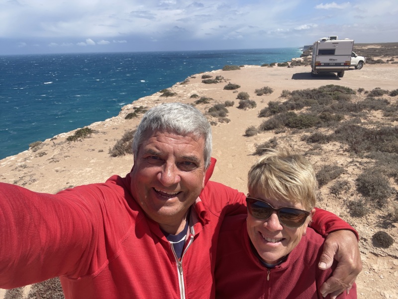
The Southern Ocean was certainly angry that day. Looking out over the cliffs there's just nothing but huge waves continuously crashing against the cliffs. No wonder they're eroding away. One day these cliffs will all be washed away and Australia will be split into two, as the Great Australia Bight becomes the Great Australian Straight. Finally WA will get their wish and be separated from the east!
It was freezing out there!
Being an old sailor Alan often dreamed about circumnavigating Australia. How to cross the Great Australia Bight always intrigued him, and looking at these cliffs, which stretch for over 200 kilometres, he can't see a way to do this safely, and certainly not in comfort. So it would have to have been a half circumnavigation of the top end and turning around in Perth and going back north over the top.
For the length of these cliffs there just isn't anywhere a boat could moor for a night or two, let alone get somewhere safe if you got into trouble.
There was absolutely no way we could have camped the night anywhere near here, so it was time to look for some shelter.
Now where do you find shelter from the wind on one of the worlds largest flat treeless plane? Answer = nowhere.
So we headed towards Nullarbor Roadhouse hoping to find some places which provided at least some shelter from the relentless wind.
The campgrounds were fully exposed to the wind, so they offered no protection.
But... the Nullarbor Roadhouse has a gravel pit with huge mounds of gravel behind it. So we tucked ourselves against these walls and managed to at least find a spot where the van wasn't being constantly rocked. It turned out this gravel pit is near their waste management facility. We knew we were near the rubbish tip because there were crows circling, and a scrawny dingo foraging for food. We found a great spot right away from them, and had a quiet night, with no smells.
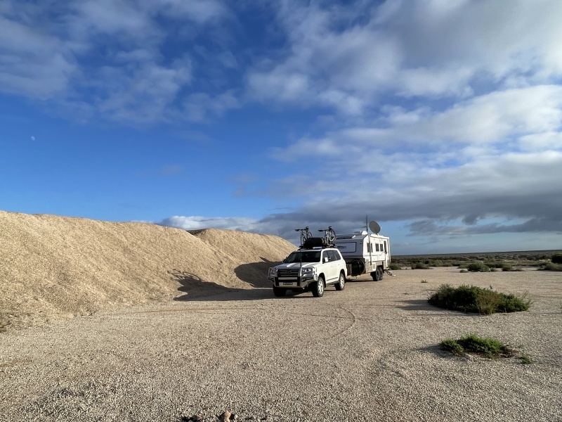
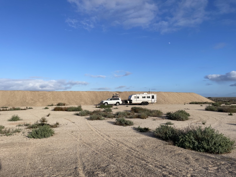
That night it bucketed down rain for about 15 minutes, the rain driving so hard we couldn't hear each other talking in the van! Imagine trying to do this in a tent! There was 1 km of clay road to get to this gravel pit. We had thoughts of the last time we were in a desert with driving rain on a dirt road and if the rain had continued it would have been a concern, but thankfully it only lasted for about 15 minutes. So no issues.
Thanks to the Nullarbor Roadhouse we not only had protection from the wind we also had great 4G phone/internet service. We got that and more, all for free.
About 40kms east of the roadhouse we instantly came to trees. Just like crossing a line, trees to the east but no trees to the west. The area was lush from the good rains they have had.
The one advantage of the constant gale force westerly winds from Norseman to Ceduna was that we got the best fuel economy that we've ever had towing our van. 22% better than normal! If we had a spinnaker on our car it would have been even lower, and probably wouldn't have even needed the engine on.
We were even able to drive at 92kms/hour with the Cruiser in 6th gear! Normally we tow in 5th gear so as to not strain the engine etc.
Fowlers Bay
We elected to stay in Fowlers Bay, a small town on the Bight with some great history. We've stayed before and had good memories, but this time it didn't live up to those fond memories!
The town is bordered on one side by massive sand dunes which are spectacular. It also has a refurbished jetty which is quite nice, but freezing cold in the wind.
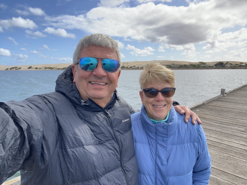
Puffer jackets came out for the first time this trip
Besides the caravan park cafe, the Fowlers Bay Kitchen advertises coffee, cakes, pizza and pasta. Sounds nice eh?
It's just someone's house where they serve very ordinary meals on their porch on very ordinary furniture!
$25 for the worst pizza we've ever eaten and the home made pasta wasn't much better! And we couldn't go into the house to use the toilet!
Still better than cooking yourselves? We don't think so, and the next night in Wudinna Jayne made the best pizza ever in our van. And it cost nowhere near $25.
Next night at Wudinna Showgrounds - $15 for power and water on a sloping area, and almost impossible to level the van. The bakery for mornos was great though.

Wudinna Showgrounds
Kimba
Last time we went through Kimba it was a bit of a sleepy hollow. However since then they've done an excellent job of marketing themselves as being "Halfway across Australia", added a giant pink galah, and painted their silos.
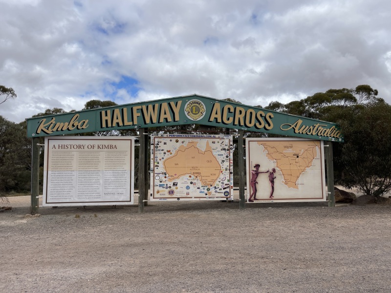
It's not actually half way across, unless you go Sydney to Perth via Melbourne, and even then its a bit shy of halfway!
Let's not let the facts detract from good advertising.
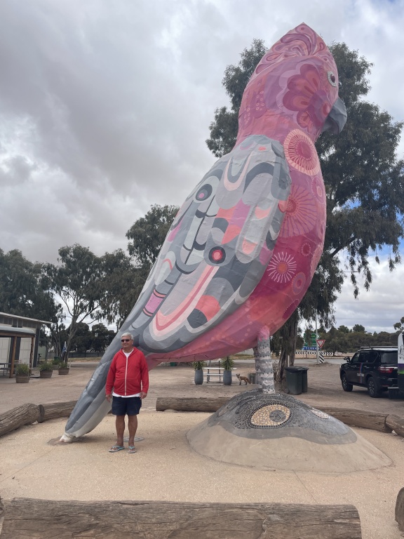
Throw in a big galah, that's the pink one, not the one in red!
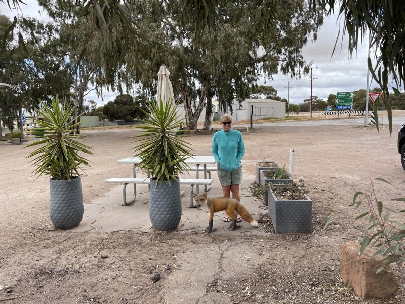
Plus a Foxy thing or two!
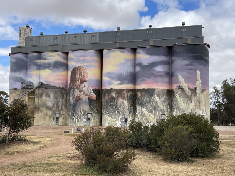
Add some silo art, and the tourists are flocking here
We've passed through Kimba several times, but never seen it so vibrant . Caravans and cars everywhere. Job well done Kimba. They also have a new large free camping area which we didn't use this trip.
Iron Knob
Alan learnt all about Iron Knob at school. We've camped there before and it's certainly a quirky place. This time we just passed through on our way to Whyalla.
Iron ore was discovered in Iron Knob in 1897 with BHP taking out a mineral claim. Mining started in 1900 and continues today. They stopped mining between 1998 and restarted in 2013, so for the last 123 years they have been pulling iron ore out of Iron Knob for 108 years! Quite impressive.
The ore was of very high quality with a purity of over 60%. In 1943 the purity was still over 64% metallic content. 21% of the steel used in the Sydney Harbour Bridge came from Iron Knob.
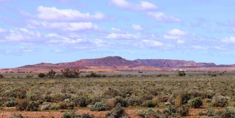
Iron Knob as seen from the road
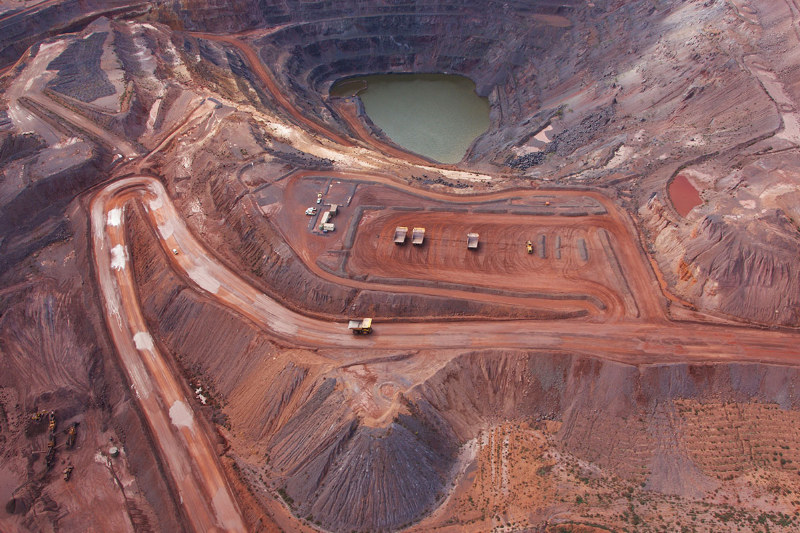
The "pit"
Whyalla
We stopped in Whyalla at the Foreshore Caravan Park. The wind is still blowing and you can hear it screaming through the door.
Whyalla Steelworks processes iron ore from Iron Knob area. They produce around 1.2 million tonnes of raw steel per year.
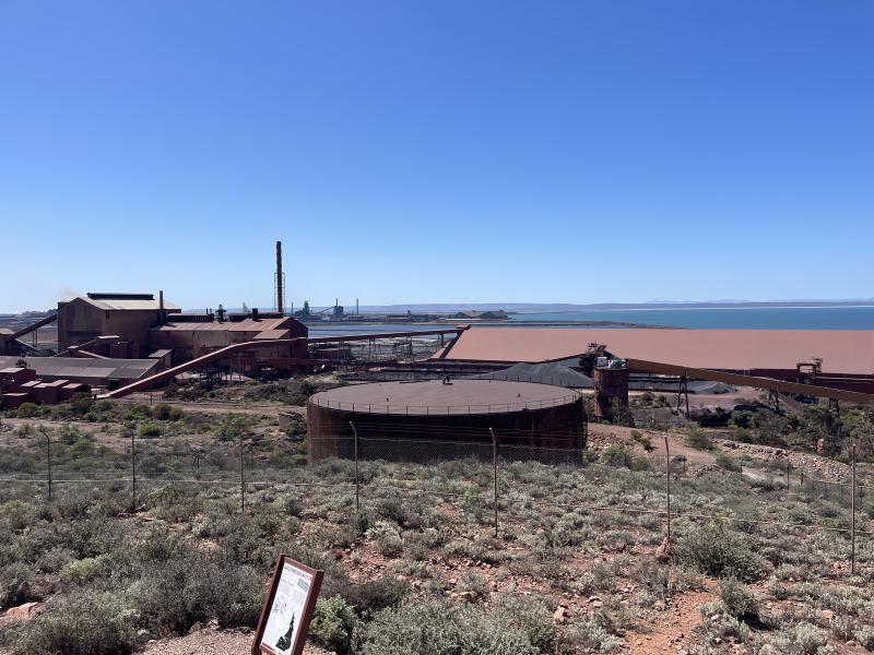
Whyalla Steelworks
The wind is still blowing but at least the sun is out
The van park is very unusual in shape and we couldn't fit onto our assigned site due to trees etc. They very quickly swapped sites with the only other vacant site and we were happy campers. The park was fully booked, so we were really lucky to end up with a better site.
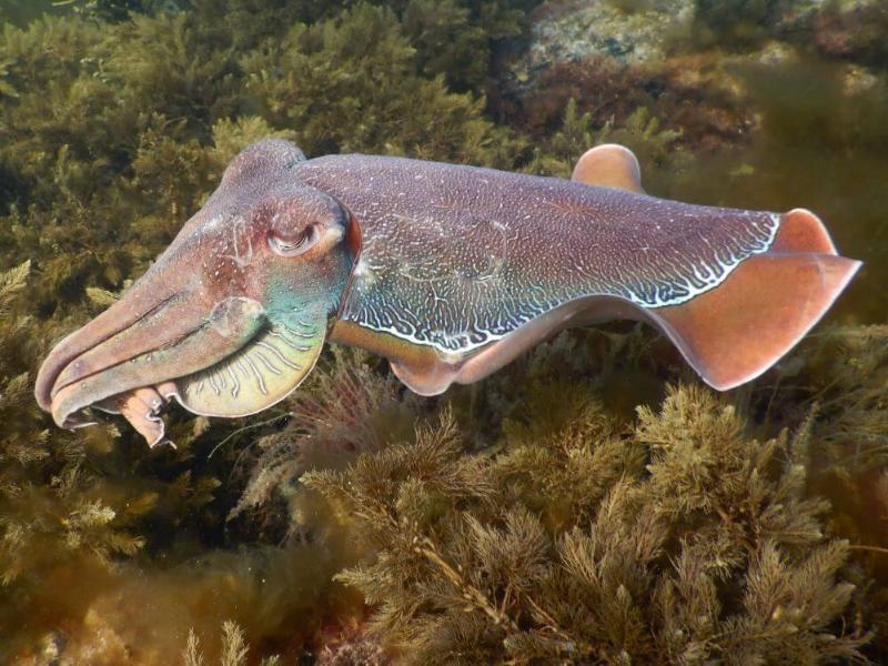
Whyalla is also famous for its Giant Cuttlefish Migration where 250,000 arrive into town to mate and reproduce. Each cuttlefish weighs up to 5 kg. You can see them in June and July, but unfortunately not October!
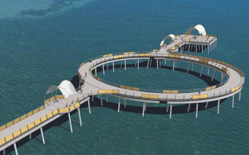
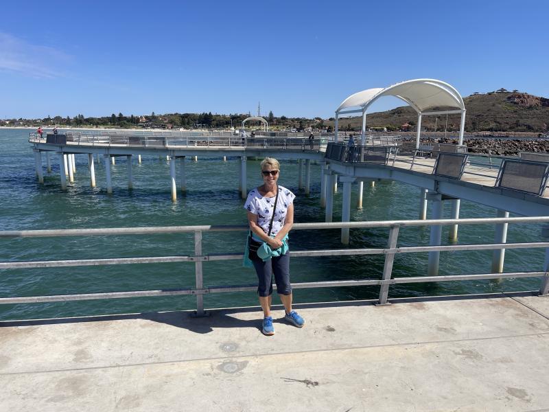
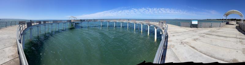
Whyalla is also famous for its new Circular Jetty.
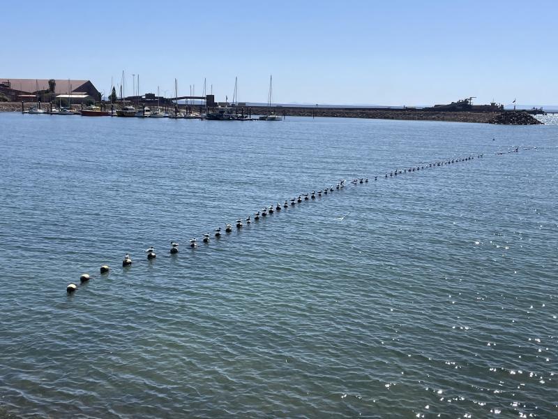
You've heard about having all you ducks in a row? On the way to the jetty each seagull had its own buoy
There was a definite pecking order here!
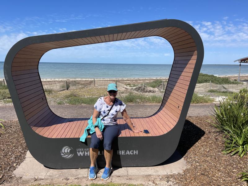
Quirky Mobile phone charging places dot the foreshore
We've had big driving days, around 300kms/day! Wow, that's a lot for us! :)
Nearly home. We'll be back home around 15th October, so this will be our second last entry for this blog